Who Negated Ned’s Life In Newcastle?
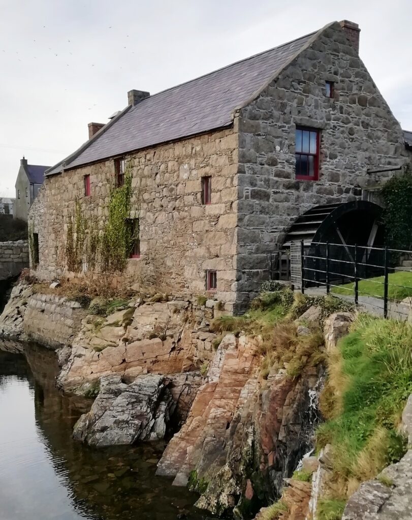
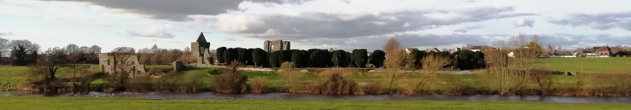
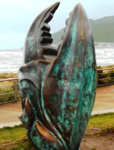 Local man Ned McKenzie has alas been found murdered in Northern Ireland’s seaside town of Newcastle. We recommend you start your murder trail at the Donard Car Park as his body was found dumped at the entrance, and evidence was also collected there. However, detectives think the murder was carried out elsewhere.
- The Newcastle Whodunit Hunt is a self-guided, walking murder mystery trail.
- On this route you will discover both historic sights and a collection of modern sculptures. You’ll hear of brandy smuggling and learn about the old granite mining industry and the history of this town which dates back 600 years! You’ll also read about an historic flight on the beach, the town’s railway connections, stories of ghosts, local myths & legends… and more!
- The clue route is approximately 2 miles, or about 3 km. It starts/ends at the coast road entrance of the Donard Park car park.
- The Whodunit Hunt booklet is packed with 28 clues to solve and LOADS of historical and tourist information to read.
 We suggest allowing at least two hours to solve this murder mystery, excluding any stops for refreshment.
- Accessibility – the route is generally fairly flat, with only moderate inclines.
- Refreshments – you’re spoilt for choice here with a large number of bars, cafes, coffee shops, restaurants, takeaways, and shops.
To pay using Paypal click here (or in the menu) to order this, or any other, Whodunit Hunt.
To purchase this Whodunit Hunt with credit / debit / Amex card please click here.
The starting point is shown in the map below, which is also where you should park if coming by car.

(c) 2023 – the term ‘Whodunit Hunt’, associated logo, website content, and all Hunt routes, ideas, images and photos, are protected by copyright. Any copying/distribution of anything embraced by our copyright is intellectual theft and therefore unlawful and illegal. Please respect the law as well as numerous years of our hard work.
Who Killed Cathy In Castlewellan?
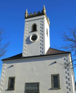
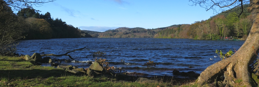
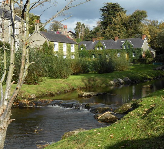
Cathy O’Reilly from Castlewellan has been murdered and detectives need your help to solve the mystery around her death. Her body was found dumped in Castlewellan lake but evidence tells us the murder was not committed here. The clue trail starts in the Lower Square of Castlewellan.
 This Whodunit Hunt is a self-guided, walking murder mystery trail.
- On the clue route you will learn about the village’s history and some of the characters that were part of it, especially the Annesley family who designed the village layout and created what is now Castlewellan’s Forest Park. See historic buildings, read about the period when Castlewellan was connected to the railway system of Northern Ireland, enjoy the beauty of the forest park, even get a ghost story thrown in for good measure!
- The clue route is 2 ¼ miles / 3 ¾ km. The starting point is shown in the map below and the route ends in Castlewellan Forest Park near the lake.
- This Whodunit has 28 clues to solve in a booklet packed with extra historical and tourist information.
- The recommended time for this murder mystery is about two hours, excluding any stops for refreshment.
- You can extend your day here by spending time in the forest park (see below photo). There are many lovely walks in the park, as well as pretty gardens (which may still be closed on certain days due to rennovations).
- Accessibility – the route is generally fairly flat, but with one hill to partly descend and climb back up.
- Refreshments – there are a number of cafes, coffee shops, and restaurants here.
To pay using Paypal click here (or in the menu) to order this, or any other, Whodunit Hunt.
To purchase this Whodunit Hunt with credit / debit / Amex card please click here.
The starting point is at the car park beside the King’s Inn, shown in the map below.
(c) 2023 – the term ‘Whodunit Hunt’, associated logo, website content, and all Hunt routes, ideas, photos, are all protected by copyright. Any copying, impersonation or distribution of anything embraced by our copyright is intellectual theft and therefore unlawful and illegal. Please respect the law as well as all of our hard work.
Who Slaughtered Shaun in Saintfield?
Shaun Magill has been sadly slain in the historical small town of Saintfield and our best investigators need your help to confirm their suspicions about the murder. Although his body was found at the ruins of the old windmill, we believe this was not where the murder was committed.
 The Saintfield Whodunit Hunt is a self-guided, walking murder mystery trail.
- Along the clue route you will come across quite a number of old buildings in this quaint village and also learn about its turbulent history, especially in the memorial garden, spanning hundreds of years.
- The clue route is 1 ¾ miles / 2 ¾ km. It starts/ends in the car park on Downpatrick Street which is signposted at a crossroads.
- This Whodunit Hunt has 27 clues and the booklet contains extra historical and tourist information not seen elsewhere in the village.
- The recommended time for this murder mystery is around two hours, excluding any stops for refreshment. The National Trust’s Rowallane Gardens is at the village outskirts nearby if you have time to extend your stay here.
- Accessibility – the route is generally fairly flat, with only moderate inclines.
- Refreshments – there are a number of cafes, coffee shops, convenience stores in Saintfield as well as the old White Horse Inn.
To pay using Paypal click here (or in the menu) to order this, or any other, Whodunit Hunt.
To purchase this Whodunit Hunt with credit / debit / Amex card please click here.
The starting point is the car park beyond the Masonic Hall on Downpatrick Street, shown in the map below.
(c) 2023 – the term ‘Whodunit Hunt’, associated logo, website content, and all Hunt routes, ideas, photos, are all protected by copyright. Any copying, impersonation or distribution of anything embraced by our copyright is intellectual theft and therefore unlawful and illegal. Please respect the law as well as all of our hard work.
Who Whacked William in Whitehead?
William White has been found murdered in the old coastal town of Whitehead and our investigators have uncovered very few leads. Therefore, we desperately need your help to solve the murder. Although William’s body was found on the beach, our detective team believe this was not where the murder was committed.
 The Whitehead Whodunit Hunt is a self-guided, walking murder mystery trail.
- Along the clue route you will discover many interesting sights, both historic and modern, in this quaint seaside village. You’ll learn about its railway history and the evolution of its tourism industry, as well as several of the characters who shaped it. You’ll see a castle and even read about a pop star who used to live in Whitehead and someone who made their home in a cave.
- The clue route around Whitehead is approximately 2 ½ miles, or about 4 km. It starts/ends in the car park at the end of the Old Castle Road in Whitehead.
- The Whodunit Hunt booklet is packed with 30 clues as well as several pieces of historical and tourism information.
- The recommended time for this murder mystery is 2-3 hours, excluding any stops for refreshment.
- Accessibility – the route is generally fairly flat, with only moderate inclines.
- Refreshments – there are a number of cafes, coffee shops, and convenience stores in Whitehead.
To pay using Paypal click here (or in the menu) to order this, or any other, Whodunit Hunt.
To purchase this Whodunit Hunt with credit / debit / Amex card please click here.
The starting point is shown in the map below.
(c) 2023 – the term ‘Whodunit Hunt’, associated logo, website content, and all Hunt routes, ideas, photos, are all protected by copyright. Any copying, impersonation or distribution of anything embraced by our copyright is intellectual theft and therefore unlawful and illegal. Please respect the law as well as all of our hard work.
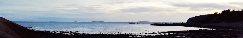
Who Murdered Cora Rohan Along The Mourne Coastal Route?
Cora Rohan’s body has been found washed up on Cranfield West Beach but our investigators have uncovered very few leads and thus need your help to solve the murder. Although Cora’s body was found on the beach, we don’t believe she drowned or was murdered here and so have advised that the evidence trail starts in Restrevor.
 The Mourne Coast Whodunit Hunt is a self-guided, driving murder mystery trail. It starts beside Restrevor’s Kilbroney river bridge and ends on the outskirts of seaside town Newcastle.
- The route includes sights spanning a broad period of history from as far back as 5,000 years ago!! You’ll come across an old castle, a mill, and a neolithic tomb for starters. You’ll also visit the seaside, read tales of smugglers and ghosts, and learn about the evolution of Kilkeel as a major port. En route you will also see lovely coastal and mountain scenery too.
- The clue route is 33 miles, or about 50 km, before your return to the starting point (or home). There is generally moderate walking at all clue stops, approximately 2 ¼ miles / 3 ¾ km in total.
- We suggest allowing about four hours to complete this Whodunit Hunt, excluding refreshment stops.
- Accessibility – once out of your vehicle the terrain is mostly quite flat, with only occasional moderate slopes; there are no steps.
 For refreshments, you will pass convenience stores, coffee shops, bars and restaurants along the route.
To pay using Paypal click here (or in the menu) to order this, or any other, Whodunit Hunt.
To purchase this Whodunit Hunt with credit / debit / Amex card please click here.
The starting point is beside Restrevor’s Kilbroney river bridge at the entrance to Fairy Glen:
(c) 2023 – the term ‘Whodunit Hunt’, associated logo, website content, and all Hunt routes, ideas, photos, are all protected by copyright. Any copying, impersonation or distribution of anything embraced by our copyright is intellectual theft and therefore unlawful and illegal. Please respect the law as well as all of our hard work.
Who Archived Andy At The Ards Peninsula?
Andy Pennant’s body has been found dumped outside the gates of Mount Stewart on the Ards Peninsula but we’re sure he was murdered elsewhere. Our best investigator is struggling to get to the bottom of the mountain of evidence collected and thus needs your help to solve the murder.
 The Ards Peninsula Whodunit Hunt is a self-guided, deluxe driving murder mystery trail. The clue trail starts at St Columbanus Church in Bangor and ends at Greyabbey.
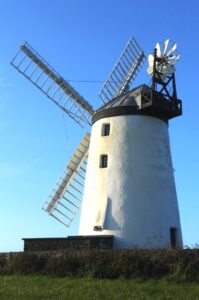
- The route includes sights as old as 1,300 years! You’ll visit the only working windmill and the first port in Northern Ireland, see old castles, impressive Grey Abbey and a much older well, stop at Ireland’s most easterly point, and learn about the evolution of this beautiful area and some of the key figures that shaped it!
- The clue route is 50 miles, or about 80 km. There is generally moderate walking, just over 3 miles / 5 km in total across all clues.
- This deluxe Whodunit Hunt is jam packed with 42 clues to solve in a booklet containing a dozen extra pieces of historical and/or tourist information! You’ll need to set aside most of a day (we suggest allowing at least six hours) to complete this Whodunit, excluding refreshment stops. Great value for hours of fun!
- Accessibility – once out of your vehicle the terrain is generally quite flat, with only occasional moderate slopes. Any steps can be avoided by taking ramps / alternative routes.
- For refreshments, you will pass a number of coffee shops, cafes, bars, restaurants and stores along the route.
To pay using Paypal click here (or in the menu) to order this, or any other, Whodunit Hunt.
To purchase this Whodunit Hunt with credit / debit / Amex card please click here.
The starting point is in the Ballyholme area of East Bangor is shown below:
(c) 2023 – the term ‘Whodunit Hunt’, associated logo, website content, and all Hunt routes, ideas, photos, are all protected by copyright. Any copying, impersonation or distribution of anything embraced by our copyright is intellectual theft and therefore unlawful and illegal. Please respect the law as well as all of our hard work.
Who Did Away With Danny Diamond?
Danny Diamond’s body has been ironically found at the Battle Of The Diamond memorial. Our best investigator is struggling to get to the bottom of the mountain of evidence that was collected and thus needs your help to solve the murder.
 The Diamond Trail Whodunit Hunt starts at the Battle Of The Diamond memorial near Loughgall and ends at historic Tynan village.
- This is a self-guided, non-circular driving murder mystery trail.
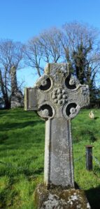
- Visit an old mansion house and gardens, ancient Irish crosses, pretty villages, and learn about key figures in their history. You’ll see a castle, a tiny graveyard, enjoy a pleasant river walk… and more!!
- There are 27 clues to solve with stacks of extra historical information about various sites squeezed into this Whodunit booklet!
- The driving route is only 26 miles, or 42km, from the start to the end point!! There is almost 3 miles / 5 km of walking in total during this Hunt, spread across all of the clues.
- We suggest allowing at least four hours to solve this murder mystery, excluding refreshment stops.
- Accessibility – it is generally flat where the clues are to be found. Sensible shoes for some clues are strongly recommended.
- Main refreshment options are in Caledon, Moy, and the cafe at Benburb priory.
To pay using Paypal click here (or in the menu) to order this, or any other, Whodunit Hunt.
To purchase this Whodunit Hunt with credit / debit / Amex card please click here.
The starting point is near Dan Winter’s Cottage, shown in the map below:
(c) 2023 – the term ‘Whodunit Hunt’, associated logo, website content, and all Hunt routes, ideas, photos, are all protected by copyright. Any copying, impersonation or distribution of anything embraced by our copyright is intellectual theft and therefore unlawful and illegal. Please respect the law as well as all of our hard work.
Who Topped Trisha In Trim?
Poor Trisha McDermott has been found murdered in the historic town of Trim and even our best investigators are struggling to tie leads together and thus need your help to solve the murder. Trisha’s body was found on Navan Gate and although detectives suspect she was murdered elsewhere they consider this is a good place to start looking for clues.
 The Trim Whodunit Hunt is a self-guided, walking murder mystery trail.
- Trim is a very historic place, in fact it has more medieval buildings than any other place in Ireland! Along the clue trail you’ll see the impressive Trim Castle, ruins of abbeys and a cathedral, learn about the Tomb Of The Jealous Man & Woman, and find out much more about this fascinating town!
- The route is almost 3.7 miles, or about 6 km, and starts/ends on Navan Gate, as shown in the map below. This is a longer walk than almost all of our Whodunits, as the ruined cathedral is along the pleasant river walk away from the town centre, so we have provided instructions in the murder mystery booklet to reduce the walking distance if required.
- The Whodunit Hunt booklet is packed with 30 clues to solve and nine pieces of extra historical information about the town and the sights you come across!
- The recommended time for this murder mystery is at least three hours, excluding refreshment stops.
- Accessibility – this is a generally quite flat route, but there are a small number of steps to navigate at/near the old cathedral site.
- Refreshments – there are assorted places available, including coffee shops and bars.
To pay using Paypal click here (or in the menu) to order this, or any other, Whodunit Hunt.
To purchase this Whodunit Hunt with credit / debit / Amex card please click here and type Trim in the ‘Special Requests’ field at the start of the purchase page.
The starting point is shown in the map below, with free parking nearby on this street.
(c) 2023 – the term ‘Whodunit Hunt’, associated logo, website content, and all Hunt routes, ideas, photos, are all protected by copyright. Any copying, impersonation or distribution of anything embraced by our copyright is intellectual theft and therefore unlawful and illegal. Please respect the law as well as all of our hard work.
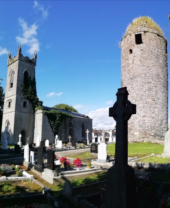
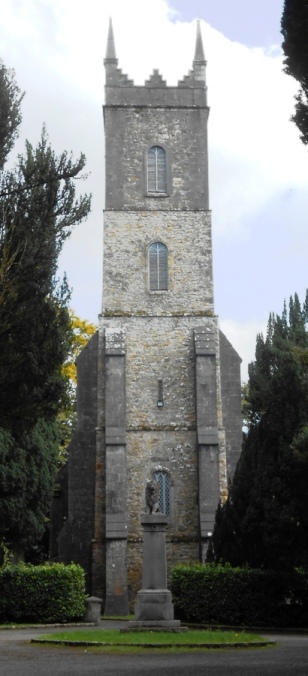
Who Dispatched Donal In Dromiskin?
Donal Rafferty has been found murdered in the lovely village of Dromiskin and we desperately need your help to solve the murder as detectives are struggling to tie up the loose ends of the case. Although Donal’s body was found at the petrol station, this is not where the murder was committed and so the murder trail starts at the old monastic and round tower site.
 The Dromiskin Whodunit Hunt is a self-guided, walking murder mystery trail.
- Dromiskin is a pretty little village with much history to discover! The focal point of its history is the monastic site, over 1,200 years old, with its tall round tower, ruined church, and old Irish Cross. Along the clue trail you’ll see numerous historical references, learn about the village’s railway heritage and the famous people who have come from here, and much more!
- The route is 1.9 miles, or about 3 km, and starts/ends at the car park beside the monastic site, shown in the map below.
- This Whodunit trail is packed with over 30 clues as well as several pieces of historical information.
- The recommended time for this murder mystery is about two hours, excluding refreshment stops.
- Accessibility – this is a generally quite flat route, with no steps.
- Refreshments – there is a petrol station with a well stocked shop, with coffee and hot food facilities.
The starting point is shown in the map below, with free car parking there.
To pay using Paypal click here (or in the menu) to order this, or any other, Whodunit Hunt.
To purchase this Whodunit Hunt with credit / debit / Amex card please click here and type Dromiskin in the ‘Special Requests’ field at the start of the purchase page.
(c) 2023 – the term ‘Whodunit Hunt’, associated logo, website content, and all Hunt routes, ideas, photos, are all protected by copyright. Any copying, impersonation or distribution of anything embraced by our copyright is intellectual theft and therefore unlawful and illegal. Please respect the law as well as all of our hard work.
Who Got Lochlan In Glaslough?
Local lad Loughlan has alas been murdered in the lovely little historic village of Glaslough. We recommend you start your murder trail at the Castle Leslie exit as his body was found there, however detectives think the murder may have been carried out elsewhere.
 The Glaslough Whodunit Hunt is a self-guided, walking murder mystery trail.
- Glaslough is a pretty little village with a LOT of history, dominated by that of the Castle Leslie estate! Along the clue trail you’ll see a number of historical sites, learn about the village’s railway history, find out about the many famous people who have visited the castle, and much more!
- The route is almost 1 ½ miles, or about 2 ¼ km, and starts/ends at the exit to the Castle Leslie estate.
- The Whodunit Hunt booklet is packed with 27 clues as well as several pieces of historical information… and ghost stories too!
- The recommended time for this murder mystery is about two hours, excluding refreshment stops.
- Accessibility – this is a generally quite flat route, with no steps.
- Refreshments – there is a good coffee shop on the main street, while more upmarket fare (including delicious afternoon tea, which should be booked the day before) can be found at Castle Leslie.
To pay using Paypal click here (or in the menu) to order this, or any other, Whodunit Hunt.
To purchase this Whodunit Hunt with credit / debit / Amex card please click here and type Glaslough in the ‘Special Requests’ field at the start of the purchase page.
The starting point is on the main street beside the marker shown below:
(c) 2023 – the term ‘Whodunit Hunt’, associated logo, website content, and all Hunt routes, ideas, photos, are all protected by copyright. Any copying, impersonation or distribution of anything embraced by our copyright is intellectual theft and therefore unlawful and illegal. Please respect the law as well as all of our hard work.
