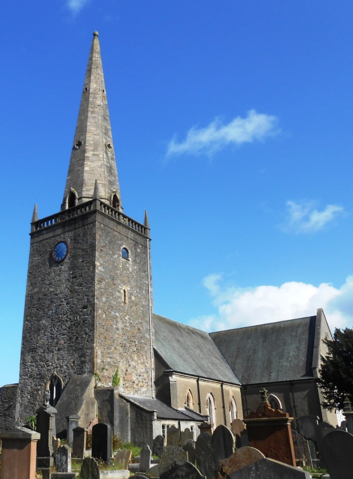
Who Bumped Off Barry In Bangor?
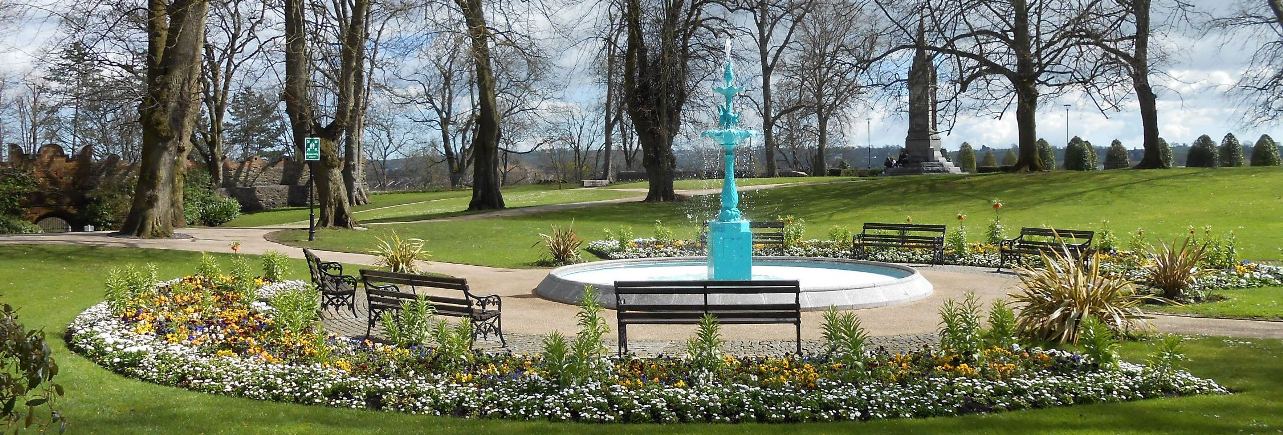
Poor Barry Mulholland has been found murdered in Bangor and our best investigator is struggling to tie up the loose ends of the case and thus needs your help to solve the murder. Barry’s body was found outside the castle, unusually within a circle of scary Halloween pumpkins, but we’re undecided as to whether the murder was committed there.
Anyone who purchased this Whodunit Hunt during the Halloween event and successfully completes it afterwards can still get a free detective certificate at the Toutist Information Office + discount code!
 The Bangor Whodunit Hunt is a self-guided, walking murder mystery trail.
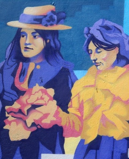
- Bangor may be known as a touristy seaside town, but it actually has a lot of historical sites with the town’s origins dating back over 1400 years! Along the clue trail you’ll see Bangor Castle, learn of the saints responsible for the early settlement of Bangor, see vibrant street murals and a gun from a World War II U-boat… and much more!
- The route is approximately 2 ¾ miles, or about 4 ½ km, and starts/ends at the railway station’s park & ride car park (see map below).
- The Whodunit Hunt booklet is packed with over 30 clues to solve as well as several pieces of extra historical information not found en-route.
- The recommended time for this murder mystery is about three hours, excluding refreshment stops.
- Accessibility – this is a generally quite flat route, although some streets have moderate inclines. There are no steps that must be navigated.
- Refreshments – there are coffee shops, cafes, restaurants, and stores along the route.
To pay using Paypal click here (or in the menu) to order this, or any other, Whodunit Hunt.
To purchase this Whodunit Hunt with credit / debit / Amex card please click here.
(c) 2023 – the term ‘Whodunit Hunt’, associated logo, website content, and all Hunt routes, ideas, photos, are all protected by copyright. Any copying, impersonation or distribution of anything embraced by our copyright is intellectual theft and therefore unlawful and illegal. Please respect the law as well as all of our hard work.
Who Destroyed Darian In Drogheda?
Darian Darcey has been found murdered in Drogheda! Our best team of investigators have uncovered few leads and thus need your help to solve the murder. Although Darian’s body was found at the railway station, we believe this was not where the murder was committed.
 This Whodunit Hunt is a self-guided, walking murder mystery trail. It starts at the Millmount Cultural Quarter and ends nearby.
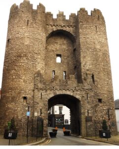
- Drogheda has been a busy town for many years as a port. Take a closer look and you discover a significant amount of history, some dating back over 800 years! On your hunt for clues you’ll come across many historic buildings and ruins, including a tower that sits on the site of a 13th Century priory, the old Corn Exchange, Laurence Gate (see photo) and impressive churches including one that houses the head of Oliver Plunkett! There is much more to discover on the trail route which has 30 clues and a booklet packed with additional historical facts!
- The clue route is 2 miles, or about 3km.
 Accessibility: the clue route is a mixture of flat parts with a few moderate inclines but no steps. However, there is quite a steep hill (Barrack Street) near the start / at the end.
- For refreshments, you will pass cafes, coffee shops, a supermarket, bars and restaurants.
The starting point of the Drogheda Whodunit Hunt is shown in the map below, with free car parking nearby.
To pay using Paypal click here (or in the menu) to order this, or any other, Whodunit Hunt.
To purchase this Whodunit Hunt with credit / debit / Amex card please click here and type Drogheda in the ‘Special Requests’ field at the start of the purchase page.

(c) 2023 – the term ‘Whodunit Hunt’, associated logo, website content, and all Hunt routes, ideas, photos, are all protected by copyright. Any copying, impersonation or distribution of anything embraced by our copyright is intellectual theft and therefore unlawful and illegal. Please respect the law as well as all of our hard work.
Who Bludgeoned Ben From Blackrock?
Poor Ben O’Sullivan from Blackrock has been sadly found murdered and our stretched investigative team are struggling to close the case. His body was found dumped on the street below the ruined windmill, and the clue hunt starts here although it is considered he was murdered elsewhere.
 The Blackrock Coastal Trail Whodunit Hunt is a self-guided, driving murder mystery trail. It starts beside the ruined windmill at Dundalk and ends at the village of Baltry, near Drogheda.
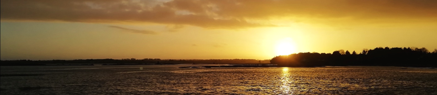
- The route includes sights spanning a broad period of history, from the invasion of the Vikings over 1100 years ago to tales from the second world war. You’ll see an old castle and ruined churches, an old Irish Cross on the site of a 7th Century monastery, learn about the development of tourism in Blackrock and a shipwreck further south, see some very large eggs… and more! En route you will also see lovely coastal scenery as you go.
- The clue route is 26 miles, or about 46km, before your return to the starting point (or home). There is generally moderate walking, approximately 2 miles / 3 km in total (not including a walk at the end to the shipwreck if you wish to do this).
- We suggest allowing at least four hours to complete this Whodunit Hunt, excluding refreshment stops.
- Accessibility – once out of the car the terrain is generally quite flat, with only occasional moderate slopes; there are no steps.
- For refreshments, you will pass coffee shops, a number of bars and restaurants, and stores along the route.
To pay using Paypal click here (or in the menu) to order this, or any other, Whodunit Hunt.
To purchase this Whodunit Hunt with credit / debit / Amex card please click here and type Blackrock Coast in the ‘Special Requests’ field at the start of the purchase page.
The starting point is on Quay Street beside the old windmill at Dundalk, shown below:
(c) 2023 – the term ‘Whodunit Hunt’, associated logo, website content, and all Hunt routes, ideas, photos, are all protected by copyright. Any copying, impersonation or distribution of anything embraced by our copyright is intellectual theft and therefore unlawful and illegal. Please respect the law as well as all of our hard work.
Who Culled Catherine In Cavan?
Catherine O’Mahony has been found murdered in Cavan and our overworked detective needs your help to confirm suspicions about the case. Catherine’s body was found at the bus depot although we’re sure this was not where the murder was committed. But we suggest you start your clue hunt at the nearby roundabout and see where the evidence leads you.
 The Cavan Town Whodunit Hunt is a self-guided, walking murder mystery trail. It starts at the roundabout next to the bus station and ends nearby.
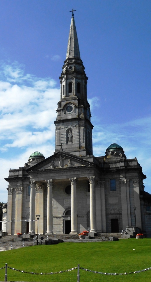
- Cavan has a medieval history dating back well over 800 years! There is much to discover on the clue trail including the remains of an old abbey, an impressive cathedral and church, the house where a famous entertainer lived, and more! Along the way the trail booklet tells you about the town’s history with some amusing tales too.
- The route is about 2 miles, or just over 3km.
- The recommended time to solve this murder mystery hunt, excluding refreshment stops, is at least two hours.
- Accessibility: this is generally quite a flat route, with no steps, and thus suitable for nearly all.
- For refreshments, you will pass cafes, supermarkets, bars and restaurants.
The starting point of this Whodunit Hunt is at the roundabout beside the Bus Eireann depot, shown in the map below.
To pay using Paypal click here (or in the menu) to order this, or any other, Whodunit Hunt.
To purchase this Whodunit Hunt with credit / debit / Amex card please click here and type Cavan in the ‘Special Requests’ field at the start of the purchase page.
(c) 2023 – the term ‘Whodunit Hunt’, associated logo, website content, and all Hunt routes, ideas, photos, are all protected by copyright. Any copying, impersonation or distribution of anything embraced by our copyright is intellectual theft and therefore unlawful and illegal. Please respect the law as well as all of our hard work.
Who Clobbered Ciara In Clones?
Local heart throb Ciara O’Leary has been found murdered in the lovely, historic town of Clones. Although Ciara’s body was found beside the old Irish cross in The Diamond, detectives doubt that the murder was committed here and so the clue trail starts at the town car park.
 The Clones Whodunit Hunt is a self-guided, walking murder mystery trail. It starts at the main town car park and ends nearby.
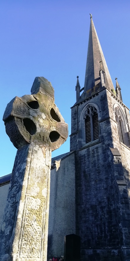
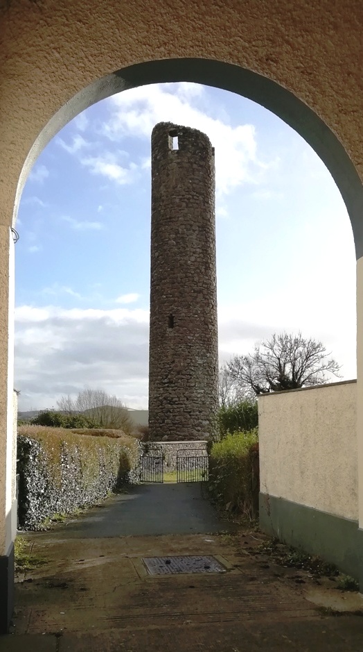
- Clones is a small but very historic town packed with historic sites, some dating back to the 5th Century! On your hunt for clues you will come across a round tower with a saint buried nearby, an ancient Irish cross, the site of a 13th Century castle, and find out about the boom and bust of the canal and railway industries at Clones. You’ll read about local boxing star Barry McGuigan too! There is much more discover once you are on the clue trail!
- Almost 30 clues to solve in a booklet packed with extra historical information and trivia.
- The route is 2 miles, or about 3km.
- The recommended time to solve this murder mystery hunt, excluding refreshment stops, is between two and three hours.
- Accessibility: this is generally a fairly flat route, with a few moderate inclines but no steps. There is one steeper path up to the site of the former castle.
- For refreshments, you will pass cafes, a convenience store, bars and restaurants. There is also a service station early in the clue hunt where you can buy sandwiches and treats.
To pay using Paypal click here (or in the menu) to order this, or any other, Whodunit Hunt.
To purchase this Whodunit Hunt with credit / debit / Amex card please click here and type Clones in the ‘Special Requests’ field at the start of the purchase page.
The starting point of the Clones Whodunit Hunt is shown below:
(c) 2023 – the term ‘Whodunit Hunt’, associated logo, website content, and all Hunt routes, ideas, photos, are all protected by copyright. Any copying, impersonation or distribution of anything embraced by our copyright is intellectual theft and therefore unlawful and illegal. Please respect the law as well as all of our hard work.
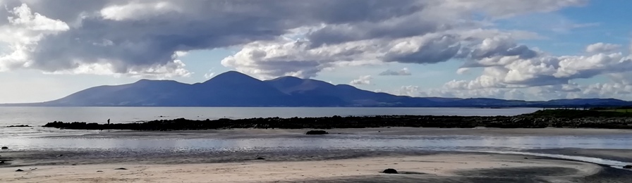
Who Liquidated Colm Along The Lecale Coast?
Colm O’Brien has been found murdered in the village of Rossglass and our best investigator is struggling to narrow down leads. We need your help to confirm their suspicions and crack the case! It is believed that Colm was murdered outside of the village and so the clue trail starts near Newcastle, at the ancient Maghera Church and Round Tower site.
 The Lecale Coast Trail is a self-guided, non-circular driving Whodunit Hunt.
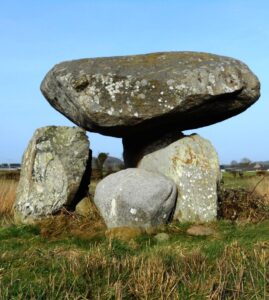
- This murder mystery trail is jam-packed with historic sites along a driving route of only 30 miles, or about 50 km. You will visit, or pass, neolithic sites including the portal tomb shown in the photo and a large stone circle, numerous castles with seven in the coastal town of Ardglass alone, and a church over a thousand years old!! You will also see several other sites, beautiful coastal scenery (including the view of the Mourne mountains shown below), and learn about several characters who have helped shaped the area’s history.
- There is generally moderate walking, about 3 miles or 5 km in total, which is spread across all of the clues. Sensible shoes are required (e.g. trainers) for the walk to the stone circle clue.
- It is recommended to allow at least four hours to solve this murder mystery, excluding refreshment stops.
- Accessibility – once out of the car the terrain is generally fairly flat, but a few clues do require reasonable mobility.
- There are assorted places for refreshment along the route in many towns and villages.
To pay using Paypal click here (or in the menu) to order this, or any other, Whodunit Hunt.
To purchase this Whodunit Hunt with credit / debit / Amex card please click here.
The starting point is shown in the map below.
(c) 2023 – the term ‘Whodunit Hunt’, associated logo, website content, and all Hunt routes, ideas, photos, are all protected by copyright. Any copying, impersonation or distribution of anything embraced by our copyright is intellectual theft and therefore unlawful and illegal. Please respect the law as well as all of our hard work.
Who Culled Clara In Castleblaney?
Clara O’Neill has been found murdered in Castleblaney and we need your help to confirm suspicions about the case. Although Clara’s body was found at the lakeside, we believe this was not where the murder was committed. Only by following the clue trail will you uncover the details behind the crime.
 This Whodunit Hunt is a self-guided, walking murder mystery trail.
- On the clue route there is much to discover around the town. You’ll learn about its origination, history, and former railway line, see historic buildings, learn about an Olympic sportsman and his many achievements (with a link to Manchester United), and discover the rich musical roots of the town. You’ll end up at the shore of beautiful Lake Muckno, where there are splendid opportunities for walks afterwards for those with some energy left!
- The route is approximately 2½ miles, or almost 4 km, and starts/ends at the Castle Hope car park.
- This Whodunit Hunt booklet has nearly 30 clues to solve and is jam-packed with extra historical and local information.
- The recommended time for this murder mystery is about 2 ½ hours, excluding any stops for refreshment.
- Accessibility – a few streets and paths have moderate inclines but you shouldn’t need to navigate any steps.
- Refreshments – there are restaurants, cafes, coffee shops, and stores along your clue hunt. We love the West Street coffee shop which you’ll pass on the main street.
To pay using Paypal click here (or in the menu) to order this, or any other, Whodunit Hunt.
To purchase this Whodunit Hunt with credit / debit / Amex card please click here and type Castleblaney in the ‘Special Requests’ field at the start of the purchase page.
The starting point at the Castle Hope car park is shown in the map below:
(c) 2023 – the term ‘Whodunit Hunt’, associated logo, website content, and all Hunt routes, ideas, photos, are all protected by copyright. Any copying, impersonation or distribution of anything embraced by our copyright is intellectual theft and therefore unlawful and illegal. Please respect the law as well as all of our hard work.
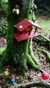
Who Slayed Steve Crook In The Slieve Croob Area??
Steve Crook has been found murdered in the Slieve Croob area, and although we know his surname is quite appropriate his petty crimes didn’t deserve such a gruesome end. Although his body was found dumped at the Slieve Croob car park it’s not clear that he was murdered here and the clue trail starts on the Castlewellan Road east of Rathfriland.
 The Slieve Croob Trail is a self-guided, non-circular driving Whodunit Hunt. It starts between Rathfriland and Castlewellan and ends at the old market town of Ballynahinch.
- You will discover quite a number of historical places on this murder mystery trail as well as see beautiful scenery. En route you’ll visit neolithic sites (including the most photographed portal tomb in Ireland), stop at a village where the remains of a flax mill are located, and learn about the evolution of Ballynahinch which dates back hundreds of years with a turbulent history.
- The clue route from start to end is 32 miles, or about 51 km.
- There is generally moderate walking, about 2 ¼ miles / 3 ¼ km in total.
 It is recommended to allow four hours to solve this murder mystery, excluding refreshment stops.
- Accessibility – once out of the car the terrain is generally fairly flat, but a few clues require reasonable mobility. We recommend taking sensible shoes… AND a torch if you fancy going on a little Indiana Jones type adventure!
To pay using Paypal click here (or in the menu) to order this, or any other, Whodunit Hunt.
To purchase this Whodunit Hunt with credit / debit / Amex card please click here.
The starting point is shown in the map below:
(c) 2023 – the term ‘Whodunit Hunt’, associated logo, website content, and all Hunt routes, ideas, photos, are all protected by copyright. Any copying, impersonation or distribution of anything embraced by our copyright is intellectual theft and therefore unlawful and illegal. Please respect the law as well as all of our hard work.
Who Murdered Mark From Markethill?
Mark Maloney from Markethill has been murdered and detectives need your help to solve the mystery around his death. Although his body was found dumped outside the entrance to Gosford Park, it is believed the murder was not committed here and he may well have been murdered outside the village.
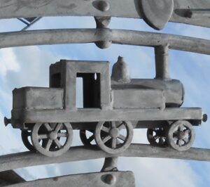
 The Tassagh Trail Whodunit Hunt is a self-guided, driving murder mystery trail. It starts at the outskirts of Markethill near Gosford Forest Park and ends at the fairy village in Darkley Forest, passing various places in the Tassagh area along the way.
- Discover numerous historical places as well as lovely natural spots. En route, learn about the history of Markethill, Keady and the Tassagh area that was influenced by the milling industry. See the second oldest graveyard in the whole of Ireland, an impressive railway viaduct, a number of lakes, visit three forest parks (all for free) with a charming fairy village in one of them… and more!
- The clue route is 36 miles, or about 58 km. There is generally moderate walking, about 2 miles / 3 km in total… unless you wish to do extra walks at any of the forest areas.
- It is recommended to allow four hours to solve this murder mystery, excluding refreshment stops. You can also do a forest walk midway, if you wish and time allows.
- Accessibility – the terrain is generally fairly flat. Some clues require reasonable mobility, with a couple having steps to climb.
- There are various refreshment options, mostly in Markethill, Keady, and Castleblaney.
To pay using Paypal click here (or in the menu) to order this, or any other, Whodunit Hunt.
To purchase this Whodunit Hunt with credit / debit / Amex card please click here.

The starting point is at Markethill shown in the map below, parking where it says B78 just off the A28:
(c) 2023 – the term ‘Whodunit Hunt’, associated logo, website content, and all Hunt routes, ideas, photos, are all protected by copyright. Any copying, impersonation or distribution of anything embraced by our copyright is intellectual theft and therefore unlawful and illegal. Please respect the law as well as all of our hard work.
Who Annihilated Liz In Lisburn?
The body of much loved local Liz Tench has been found in Lisburn. Although Liz’s body was found near Union Bridge in the river Lagan, we believe this was not where the murder was committed. The coroner confirms drowning was not the cause of death and so we need your help to confirm our suspicions about the murder.
 The Lisburn Whodunit Hunt is a self-guided, walking murder mystery trail.
- Although the centre of Lisburn is fairly modern, on this route you will discover the other side of the town which contains a wealth of history. You’ll learn about the once-thriving linen industry, see many historical sites including the cathedral and beautiful Castle Gardens, and learn about the history of the town. You’ll come across some of the characters who shaped the area too, including Sir Richard Wallace who was greatly liked by the town’s population at the time.
- The route is 2¼ miles, or 3¾ km, and starts/ends near the Lagan Valley Island complex.
- This Whodunit trail is jampacked with over 30 clues in a booklet with several pieces of extra historical information.
- The recommended time for this murder mystery is 2-3 hours, excluding refreshment stops.
- Accessibility – this is a generally quite flat route, although some streets have inclines such as Bridge Street.
- Refreshments – there are a number of options, including coffee shops, cafes, and stores. We just have to mention our favourite, Crema on Bow Street, which has extra-special sweet treats on Fridays – we love their rhubarb and custard cruffins!
To pay using Paypal click here (or in the menu) to order this, or any other, Whodunit Hunt.
To purchase this Whodunit Hunt with credit / debit / Amex card please click here.
The starting point of this Whodunit Hunt is shown below:
(c) 2023 – the term ‘Whodunit Hunt’, associated logo, website content, and all Hunt routes, ideas, photos, are all protected by copyright. Any copying, impersonation or distribution of anything embraced by our copyright is intellectual theft and therefore unlawful and illegal. Please respect the law as well as all of our hard work.
